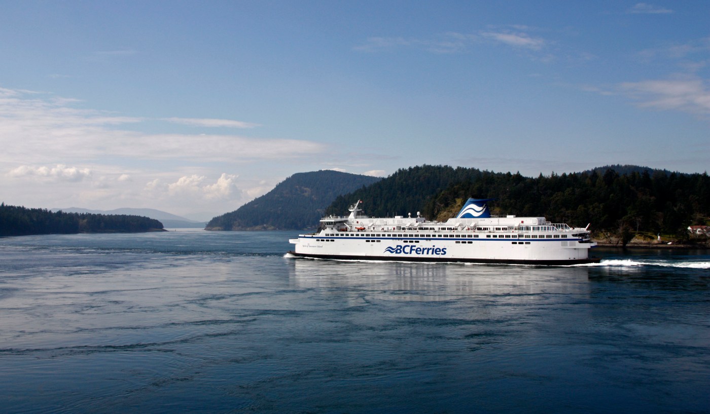
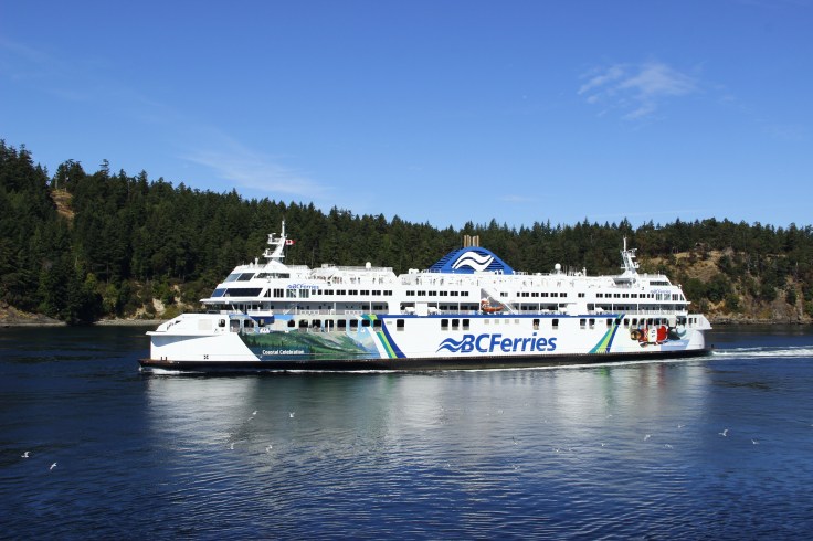
Most people who live in the Greater Vancouver area, or on the southern tip of Vancouver Island, are very familiar with the B.C. Ferry route that goes between Vancouver (Tsawwassen Terminal) and Victoria (Swartz Bay). This trip takes about 1.5 hours and is the main way for residents, and visitors, to travel between these two places.

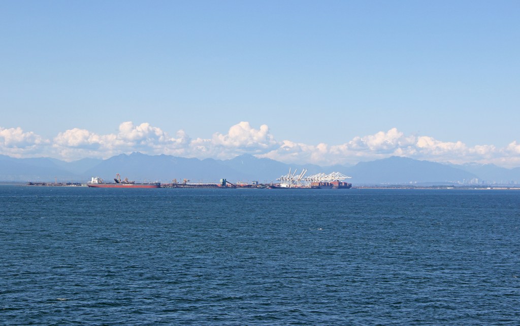
Because most visitors will start their trip from the Vancouver (Tsawwassen) terminal this is the way we will travel in this blog. Departing from Tsawwassen you will first pass across open water called the Strait of Georgia. As you leave the ferry terminal you will see the Roberts Bank Superport…the busiest coal export terminal in North America. In the background are the North Shore mountains which provide year-round enjoyment for people living in and around Vancouver.
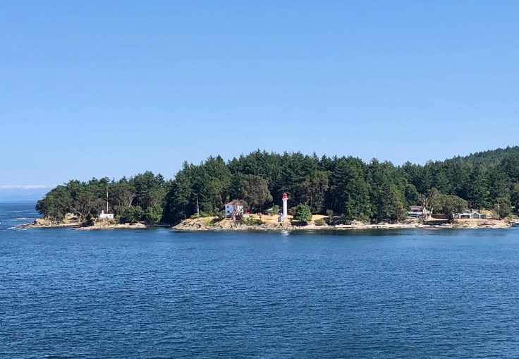
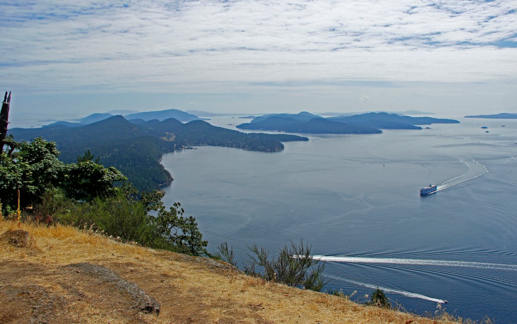
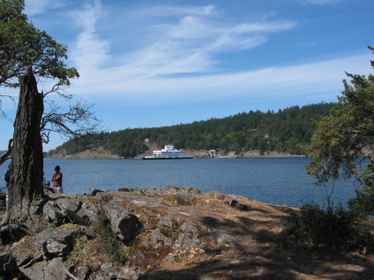
Before long the ferry will start navigating the area called Active Pass, the strait that separates Galiano Island and Mayne Island. When facing the front or bow of the ferry, Galiano Island will be on the starboard (right) side and Mayne Island will be on the port (left) side. The lighthouse that you can see on Mayne Island is part of the Gulf Islands National Park Reserve which was created in 2003 to help protect the unique ecosystems that exist on and around the islands.
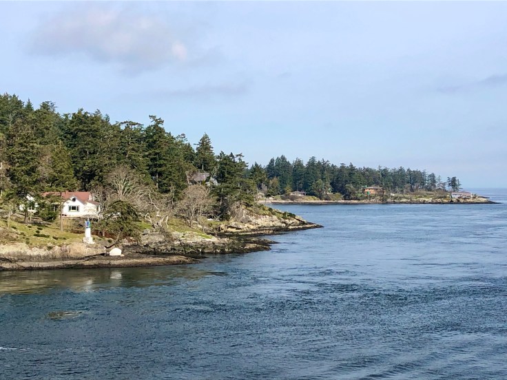
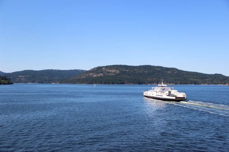
Active Pass got its name from the USCS Active, a U.S. Navy boat that was the first ship to navigate this area in 1855. Today, with the ferries, sailboats, and fishing boats, as well as sea life that uses this strait, it is very “active” and there is always something to look at. If you are lucky you might spot some of the southern resident orcas which are sometimes seen when the ferry is either entering or exiting the strait.

At just over 300 meters at its skinniest, the route through Active Pass provides some gorgeous views of both the islands and any other ferries that are passing through at the same time.
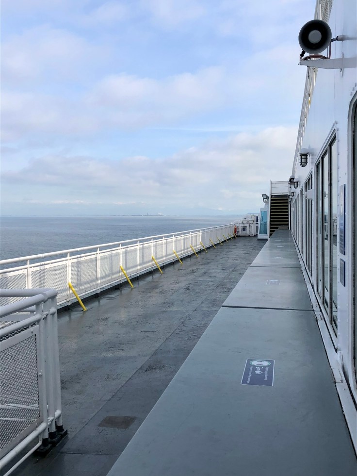
There are plenty of places to sit on the ferry. Find a spot, sit back, and enjoy the spectacular scenery. On board you will also find a gift shop as well as options to grab a bite to eat or a quick coffee.
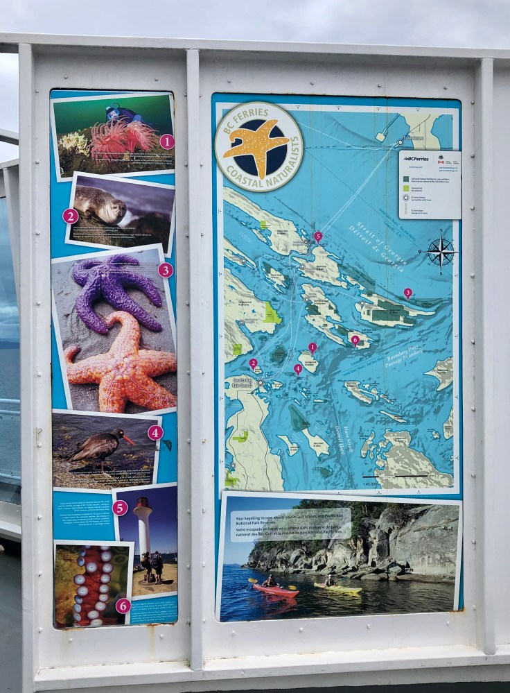
During some sailings there may be a naturalist on board to share knowledge with passengers about the plant and animal life that can be found both above and below the water in this area. Information signs also show the ferry route, as well as provide facts about the sea life in this region.
As the ferry leaves Active Pass it will pass beside Prevost Island with a very picturesque lighthouse perched on a small hill called Portlock Point. This lighthouse was built in 1895 and was automated in the late 1960’s. Most of this island was bought in the 1920’s to be used as a farm to raise sheep, goats, and cows. The area around this lighthouse is also part of the Gulf Islands National Park Reserve.

Once you have left Active Pass and sailed past Mayne Island, the next island will be Pender. Pender Island is actually two islands, North Pender and South Pender, which are separated by a narrow canal and joined together by a one-lane bridge. Pender Island is also the location of the Canada Customs Border Agency for anyone arriving into Canada by boat through the Southern Gulf Islands.
The largest of the gulf islands, Salt Spring Island, will be the last island on your right or starboard side before you reach your destination of Swartz Bay. Salt Spring Island is the most populated of the islands and is a popular getaway for people from both Vancouver and Victoria. All of the Southern Gulf Islands that are mentioned here are connected by smaller ferries with open decks for cars and trucks. These Gulf Island ferries provide service to the islands from the Vancouver mainland, as well as from Vancouver Island.
Once you have arrived at Swartz Bay it takes approximately 45 minutes to drive into downtown Victoria. There are also public buses that meet the ferries for those passengers that have walked on.
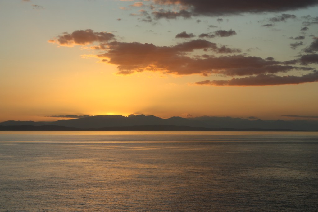
The B.C. Ferries operate from Vancouver to Vancouver Island every day of the year and have multiple sailings a day. Sometimes the best time to travel can be in the evening, when sunsets over the water are pure magic.
One thing to keep in mind is that this ferry crossing, as well as the smaller Gulf Island ferry routes, do fill up quickly in the summer months and especially over any long weekends. My advice would be to book a reservation on the ferry and ease your mind about getting on. You can find more information about the B.C. Ferries at this website.
For some ideas of what to see in Victoria check out this post.

I’ve taken the ferry a few times. It feels more like a tourist cruise to look at the gorgeous scenery. I love that picture above Active Pass. Maggie
LikeLiked by 1 person
It is very scenic. Every time I travel the route I see something new. Thanks for reading!
LikeLike
After visiting Seattle and using the ferry system there, we can’t wait to return and extend our travel up to Vancouver and experience these ferries and the Southern Gulf Islands. Great pics for this stunning environment.
LikeLiked by 1 person
Thank you….it’s a very scenic trip once you get past the open water leaving the Tsawwassen terminal.
LikeLike
Beautiful sunset
LikeLiked by 1 person
Thank you…sometimes those sunsets over the water are just so pretty 🙂
LikeLiked by 1 person
I’ve never been to Vancouver but it’s on my list! Would love to sail the southern gulf islands…beautiful!
LikeLiked by 1 person
The city is nice but the areas around it are where the real attractions are. Thanks for reading.😀
LikeLike
How beautiful! You know I have a thing for islands, and although I’ve never been to Vancouver or BC generally, I know that I’d enjoy my time there! This also reminds me of a cheesy Grey’s Anatomy quote – I have a thing for ferry boats. 🙂
LikeLiked by 2 people
Hahaha that’s soooo funny! Love a good older Grey’s episode. Hope you’re enjoying your island life 😀 come visit here one day and check out our islands…a bit pricey to buy here though!
LikeLiked by 1 person
If I didn’t know what the article was about, I’d think the photos were from Stockholm or Helsinki. The islands look so amazingly similar! Looks like a fun and different way to see the area.
LikeLiked by 2 people
Thank you for reading and commenting. It did come through ok 🙂 It’s definitely one of the more scenic routes between the Lower Mainland and Vancouver Island. I find it fascinating that they look similar.
LikeLiked by 2 people
I well remember my first trip on BC ferries, and what a great holiday that was! I fell totally in love with Victoria. Thanks for reviving happy memories.
LikeLiked by 1 person